File:92j2wedge.jpg
Jump to navigation
Jump to search
Size of this preview: 783 × 599 pixels. Other resolution: 1,500 × 1,148 pixels.
Original file (1,500 × 1,148 pixels, file size: 603 KB, MIME type: image/jpeg)
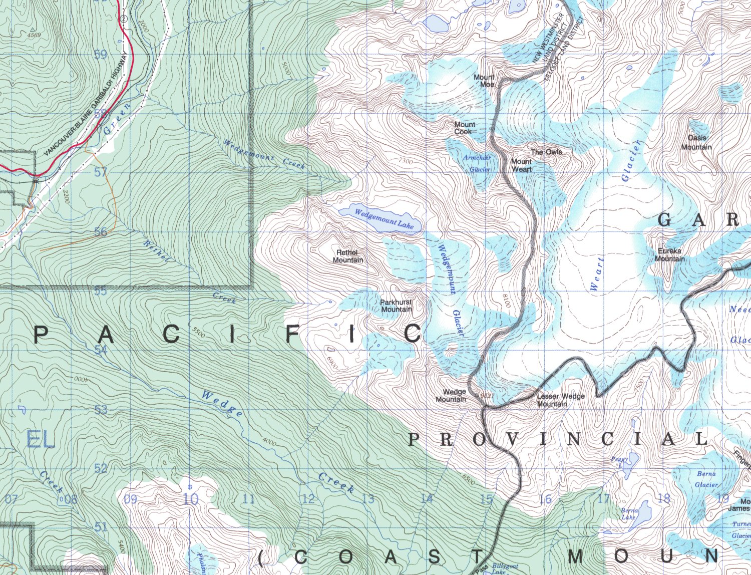
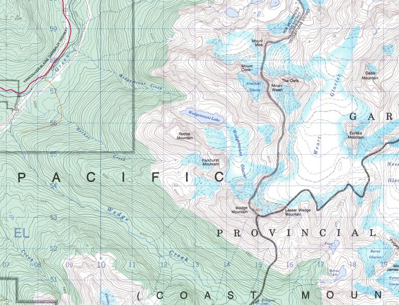
Crop of 92j2 NTS map showing Wedgemount Lake area. NAD 27 datum, 100 foot contour interval. Easting is 5xx000, northing is 55xx000.
File history
Click on a date/time to view the file as it appeared at that time.
| Date/Time | Thumbnail | Dimensions | User | Comment | |
|---|---|---|---|---|---|
| current | 03:53, 26 November 2025 | | 1,500 × 1,148 (603 KB) | Maintenance script (talk | contribs) | == Summary == Importing file |
You cannot overwrite this file.
File usage
The following 3 pages use this file: