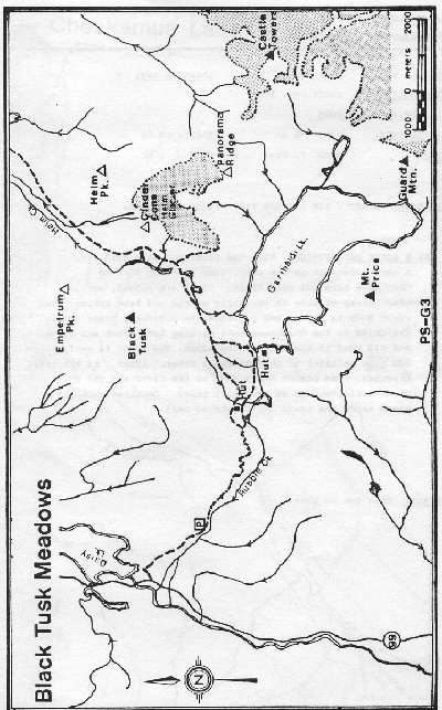
Black Tusk Meadows: Difference between revisions
imported>ScottN No edit summary |
imported>Matthew |
||
| Line 16: | Line 16: | ||
|- | |- | ||
| Intermediate | | Intermediate | ||
| | | {{NTS link|092|g|14}} | ||
| <3km/<30mins | | <3km/<30mins | ||
| 7km/3hrs | | 7km/3hrs | ||
Revision as of 23:18, 20 February 2008

Route at a Glance
| Rating | Map Refs | Road | Route | Start Elevation | High Point | Technical Notes |
| Intermediate | 92 G/14 | <3km/<30mins | 7km/3hrs | 610m | 1650m | Day trip, Shelter in meadows |
Access
The Rubble Creek turnoff for the Garibaldi Lake Trail is located about midway between Squamish and Whistler (Google Map), about 250km return. There is a prominent sign, Garibaldi - Black Tusk trailhead, indicating the turnoff. The road leads about 2km to the parking lot at approximately 600m elevation. Only the first 400m of this road is normally plowed in winter, up to a private driveway. Do not block access to this private driveway when parking along the road.
Route
From here a well maintained trail switch-backs up paralles with Rubble Creek. At a sign posted junction take the left fork to Black Tusk Meadows (right for Garibaldi Lake). The trail is poorly marked after entering the meadows. Ski eastward to reach the picnic shelter. The upper meadows, Panorama Ridge and Black Tusk may be reached by continuing to the east. These objectives are strenuous day trips from the car.
Hazards
- Avalanche