File:Nelson-BonningtonMapwithHuts82F6.PNG: Difference between revisions
Jump to navigation
Jump to search
imported>LeeWasi This is a map of Nelson and the area just to the south including the terrain covered by the Bonnington Traverse. I've used oziexplore and the coords on the website to kind of figure out where the huts are. http://www.kootenaymountaineering.bc.ca/cabins.h |
(No difference)
|
Revision as of 19:28, 15 December 2008
This is a map of Nelson and the area just to the south including the terrain covered by the Bonnington Traverse. I've used oziexplore and the coords on the website to kind of figure out where the huts are.
File history
Click on a date/time to view the file as it appeared at that time.
| Date/Time | Thumbnail | Dimensions | User | Comment | |
|---|---|---|---|---|---|
| current | 03:53, 26 November 2025 | 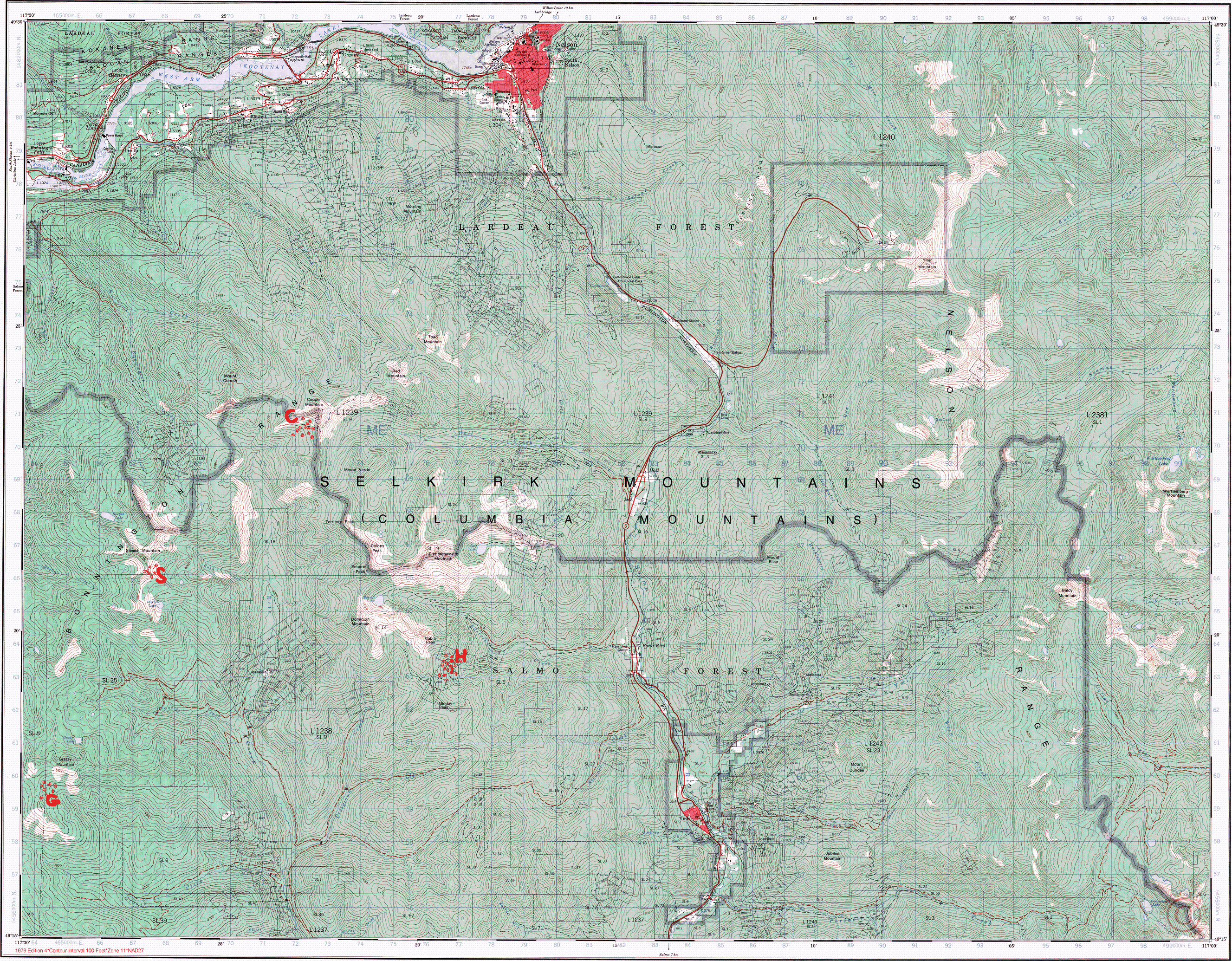 | 2,654 × 2,070 (2.37 MB) | Maintenance script (talk | contribs) | == Summary == Importing file |
You cannot overwrite this file.
File usage
The following page uses this file: