Brohm Ridge: Difference between revisions
Jump to navigation
Jump to search
imported>Hairycow |
imported>Hairycow No edit summary |
||
| Line 1: | Line 1: | ||
[[Using This Ski Guide]] | |||
==Route at a Glance== | ==Route at a Glance== | ||
Revision as of 03:08, 30 January 2008
Route at a Glance

| Rating | Map Refs | Road | Route | Start Elevation | High Point | Technical Notes |
| Beginner | 92G/14E | <7km/<2hrs | 6km/2hrs | 640m | 1800m | Day trip, Designated snowmobile area, end of road 1250m |
Access
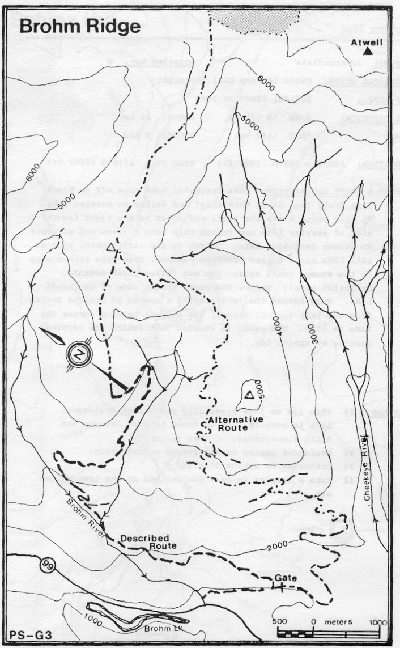
Take second Brohm Ridge turn off, turning right after crossing the Brohm River. After about 1km the read intersects with the first highway turn off and also forks north and south. The south fork is now locked, but is drivable to the snowmobile lodge (~1270m). Currently the left (north) fork offices the best access. Head north and stay on the east tributary of Brohm River and take high spurs to just below Brohm Ridge.
Route
The route on the ridge is partially flagged, but the ridge is sufficiently well defined not to present any route finding difficulties
Hazards
- Snowmobiles