Phelix Creek Trail: Difference between revisions
Jump to navigation
Jump to search
imported>George No edit summary |
imported>George No edit summary |
||
| Line 13: | Line 13: | ||
| GPS=[[Media:Phelix_trail.kml]] | | GPS=[[Media:Phelix_trail.kml]] | ||
| Maps={{NTS link|092|J|10}} | | Maps={{NTS link|092|J|10}} | ||
*[[ | *[[Waddington_hut_access_map.pdf|2012 Access Map (created by Matt Parisien)]] <br> | ||
* <br> | * <br> | ||
* | * | ||
}} | }} | ||
Revision as of 07:23, 26 December 2017
| Phelix Creek Trail | |
|---|---|
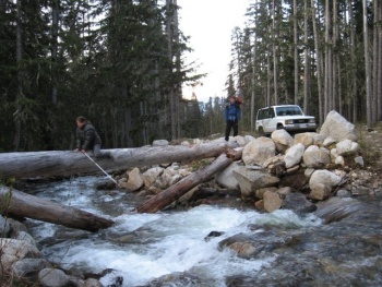
 The Log Bridge crossing near the end of Phelix Creek FSR in 2009. | |
| Length | 4.2 km |
| Class | Class 1 |
| Status | Clear |
| Access | Phelix Creek FSR |
| Destination | |
| Caretaker | Varsity Outdoor Club |
| Legal |
|
| GPS | |
| Maps | |