Mount Sedgwick

Route at a Glance
| Rating | Map Refs | Road | Route | Start Elevation | High Point | Technical Notes |
| Advanced | 92G/11W | <5km/3hrs | <9km/2days | 0m | 2070m | 2-3 days |
Access
There used to be a ferry out of Darrel Bay to reach Woodfibre, but this ferry is not longer in service. Once at Woodfibre, drive up the road on the left, just inside the gates. Follow this road until an aluminum footbridge is reached. This should be obvious, but time changes things.
Route
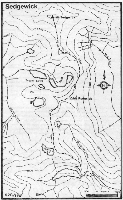
Follow the old road across the bridge and to the right. The trail begins here. Follow the trail up to Henrietta Lake to the north side of the ridge. Past here the route is porly marked. After Woodfibre Like, take the ridge leading northeast to Mount Rederick, with the Taquet Lakes below. Then swing north to a sub-peak of Sedgewick and to a Col beyond (steep). The peak is easily reached from here.
Hazards
- Extreme avalanche hazard on the SW face of Sedgewick
- Serious route finding problems in bad weather (allow for an extra day if weather is poor).
- On your return take the SE not SW ridge off the sub-peak of Sedgewick. Start traversing SW just north of Roderick to avoid wandering down the south-east ridge of Roderick.