McGillivray Pass

Route at a Glance
| Rating | Map Refs | Road | Route | Start Elevation | High Point | Technical Notes |
| Intermediate | 92J/10, 92J/15 | 14km/5hrs | ?km/?days | 1220m | 1860m | Cabin, 3-4 days |
Access
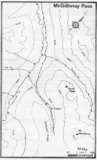
There are several summer routes to this area, but only one winter route; Vancouver-Hope-Lillooet-Goldbridge-Bralorne. From Bralorne the road is plowed to the Pioneer Mine. The McGillivray access is across the bridge on the right. Follow Cadwell Creek road for 7km to a bridge across Piebiter Creek. Take the right fork and follow the road on a long rising traverse into Standard Creek and the McGillivray Pass Valley.
Route
There is a small cabin to the right as the trail emerges above tree line. The VOC's McGillivray cabin is just beyond this on the track. The cabin is open all year round except Thanksgiving, and Christmas to New Years.
Hazards
- The entire pass area is prone to high avalanche hazard, particularly in the spring.