Telemagique Ridge
| ||||||||||||||
| ||||||||||||||
| <bcmap>lat=50.170 | ||||||||||||||
| ||||||||||||||
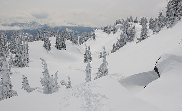
Telemagique Ridge is the ridge that divides Callaghan Creek from Madeley Creek. Skiing along the ridge is an easy pleasant ski trip that is in many ways similar to the Diamond Head area of Garibaldi Park, but without the developed trails, facilities, or throngs of people. Access to the subalpine meadows is easy, as there is only a short section of skiing through forest to connect the end of a logging road with the start of the subalpine meadows. The meadows lead up to the ridge crest, which has a unique feature in that there is a gully running right along the top of the ridge. While this blocks some of the views, it minimizes the up & down along the route and makes navigation very easy. In poor weather, the gully offers shelter from the usual ridgetop winds and blowing snow. At the north end of the ridge, the gully ends above Telemagique Lake. This area has some really nice ski runs on north facing slopes, and a few interesting little summits that can be climbed. More adventurous travelers can continue north over the ridge on the far side of Telemagique Lake and continue the tour around to Callaghan Lake.
Access
Take the Callaghan Valley Road towards Whistler Olympic Park. Turn left just before a 180 degree hairpin turn. This is the entrance to the Callaghan Country Parking Lot. As of March 2022, backcountry users on the Callaghan Country XC trail system must purchase a full price XC trail pass ($29.50). Tickets can be purchased online or at the ticket booth. Outside of the Christmas holidays, Callaghan Country is open 5 days per week, Friday - Tuesday. The trails are not groomed on Wednesdays or Thursdays. There is also a one way snowcat shuttle service to Callaghan Lake on Saturday morning.
Day use parking to Callaghan Valley area is only open when the gates are open which seems to be at 8am. Overnight parking is only permitted at Alexander Falls parking lot, about 200m south on Callaghan Valley Road.
Route
Right/left are for uphill travel. The route starts out on groomed XC trails. Snowshoing is permitted.
- From the Callaghan Country parking area, follow Mainline trail towards Callaghan Lake for 2.8km to Sparkplug corner. Take the ungroomed branch road uphill on the right.
- The branch road quickly switchbacks, and then forks a couple hundred meters later. Take the left fork (another switchback), heading north. The right fork (straight ahead) is not shown on maps.
- At the ridge crest the road forks again. Take the left fork, which stays just left of the ridge crest. The left fork is not shown on maps, but is visible in google earth. The right fork goes to Woods Lake.
- From the end of the road at 1240m, head up into the forest, trending slightly right at first. Keep just to the right of a creek gully, then cut left to the top of the gully where it levels out. This brings you to a flat clearing at 1400m that is the first of a series of interconnecting meadows.
- Follow the creek up an open gully, either directly up the creek or in the forest to the left.
- Continue to follow the creek through a steep sided basin at 1430m, then cut back left when the opportunity presents itself. More meadows lead to a level bench that traverses over to another draw.
- Follow the big draw up, and along the ridge top. Yes, there is actually a little gully running parallel to the top of the ridge.
- The draw ends just west of the summit of Telemagique Ridge. There are lots of great little skiing slopes in this area.
- Return back along the ridge, or drop down west to the XC trails at Callaghan Lake, or East to the XC trails near Madeley Lake.
Hazards
- Avalanche terrain - The main route along the ridge is Simple avalanche terrain (similar to the Elfin Lakes winter route in Garibaldi Park), but there are some steeper avalanche slopes around, especially near Telemagique Lake and further north. The route is not marked like Elfin so it's important to be able to identify avalanche terrain.
Photos
