Phelix Creek Trail
| Phelix Creek Trail | |
|---|---|
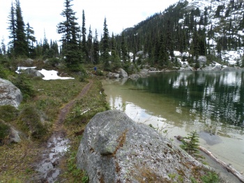
 Phelix Creek Trail as is goes around the lake on they way back to civilization. | |
| Length | 4.0 km |
| Class | Class 1 |
| Status | Clear |
| Access | Phelix Creek FSR |
| Destination | Brian Waddington Hut |
| Caretaker | Varsity Outdoor Club |
| Legal |
|
| KML | |
| Maps | |
| Avalanche Hazard | |
| The route and terrain described here is capable of producing avalanches. Safe travel requires the skills and equipment to assess and mitigate avalanche hazards. A professionally taught training course is highly recommended. |
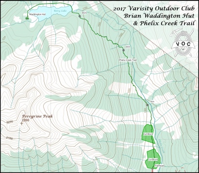
The Phelix Creek Trail is a 4.0km trail that links Brian Waddington Hut to the Phelix Creek FSR. The trail travels through a few old cut blocks before continuing on a moderately steep ascent of second growth forest that follows Phelix Creek. The valley is consistently steep from trail to peak and as a result landslides and avalanches are fairly common. This is the reason why much of the trail travels through second growth rather than old growth forests. There is one major crossing at the outlet of Betsy Lake (3.2km from the trailhead).
Trailhead

The trailhead officially begins at the end of the Phelix Creek FSR but if you have 2WD or if you are going up to the Hut in winter you likely will be starting your hike at the start of the FSR rather than the end. Even if you are going in the summer and you have a 4WDHC it's still advisable to park at the second bridge and you likely will not be starting you hike at the official trailhead but instead where you decide park.
Summer Approach
| 2WD | 4WDHC | |
|---|---|---|
| Parking Location | 0.2km up Phelix Creek FSR @ elev. 710m / 54.5km from Pemberton | 4.4km up Phelix Creek FSR @ elev. 1150m / 58.7km from Pemberton |
| Hiking distance | 9.6km | 5.2km |
| Elevation gain | 1,000m (3,280 ft) | 560m (1,840 ft) |
| Approximate time | 5 hours in / 4 hours out | 3.5 hours in / 2.5 hours out |